
Beddgelert Forest, near Beddgelert
Huge forest in the heart of Eryri National Park
The village of Dolwyddelan is in the southern part of Gwydir Forest Park.
It grew into a large community when the nearby slate quarries were at their peak.
Nowadays it offers visitors a chance to get off the beaten track within Eryri National Park.
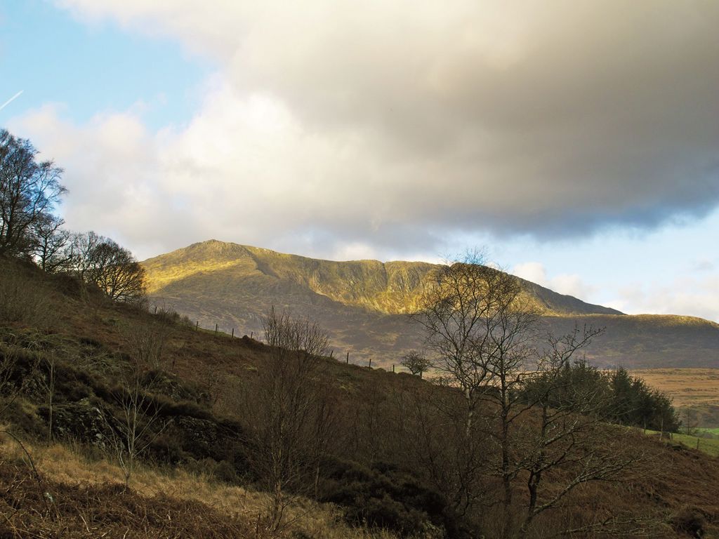
The waymarked walking trail has great views of the head of the valley and across to the mountain of Moel Siabod, and the route follows part of the Sarn Helen Roman road, used by legions of Roman soldiers marching between the fort at Caerhun and their large camp at Trawsfynydd.
The short cycle trail also has great views of the surrounding mountains.
There is a picnic area by the footbridge over the river, halfway along the walking trail.
The walking trail is waymarked from start to finish.
Look out for the information panel at the start of the trail.
Find out about walking trail grades.
Take in a great view of the head of the valley and across to Moel Siabod.
The trail climbs gradually through the village and up a forest road with the valley opening up before you.
At the bridge admire the views of the rugged Carreg Alltrem, popular with climbers.
You return to Dolwyddelan along the Sarn Helen Roman road.
The route goes past the ruins of Tai Penamnen - look out for the information panel and learn about the original house, linked to the Wynns of Gwydir Castle, which dates back to at least the 15th century.
All our mountain bike trails are waymarked from start to finish and have been graded for difficulty.
At the start of the trail there is an information panel – please read this before setting off.
Enjoy stunning views of the valley and surrounding mountains.
Dolwyddelan is in Gwydir Forest Park.
Gwydir Forest Park lies in the heart of the Eryri National Park and encircles the village of Betws-y-coed.
Lead and zinc mining once dominated the area and the legacy of old engine-houses, waste tips and reservoirs are characteristic features of the forest landscape today.
Several of the most important mines have been partially restored and made safe for visitors.
Waymarked trails start from Betws-y-coed and several other Natural Resources Wales car parks in Gwydir Forest Park:
Gwydir Forest Park is set in Eryri National Park.
Eryri is the largest National Park in Wales and is home to picturesque towns and villages and the highest mountain in Wales.
It is looked after by the Eryri National Park Authority.
For more information about visiting Eryri go to the Eryri National Park Authority website.
We want you to return home safely after your visit here.
You are responsible for your own safety as well as the safety of any children and animals with you during your visit.
For advice and tips to help you plan your visit here go to Visiting our places safely.
See the top of this webpage for details of any planned closures or other changes to the trails here.
For your safety, always follow instructions from staff and signs including those for trail diversions or closures.
We may divert or close trails whilst we undertake maintenance work or other operations and we may need to close other visitor facilities temporarily.
In extreme weather, we may close facilities at short notice due to the risk of injury to visitors and staff.
You may need permission from us to organise an event or to carry out some activities on our land.
Check if you are allowed to use our land.
We recommend you follow these directions or use the Google map below which has a pin on this place’s location.
Dolwyddelan is 6 miles south west of Betws-y-coed.
Take the A470 from Betws-y-coed towards Blaenau Ffestiniog.
After approximately 6 miles turn left by the shop into the village of Dolwyddelan.
Continue along this road and then turn left into the railway station car park where the walking trail starts.
The Ordnance Survey (OS) grid reference for the start of the trail is SH 737 521 (Explorer Map OL 18).
The postcode is LL25 0SZ. Please note that this postcode covers a wide area and will not take you directly to the entrance.
View this place on the What3Words website.
The nearest mainline railway station is in Dolwyddelan.
For details of public transport go to the Traveline Cymru website.
The walking trail starts from the car park at Dolwyddelan railway station.
This car park is managed by the local community and there is a parking charge.
There are no staff at this location.
Contact our customer team for general enquiries during office hours, Monday to Friday.


