
Alwen Reservoir, near Denbigh
Walk or cycle around this huge upland reservoir
Located at the eastern end of Clocaenog Forest, Coed y Fron Wyllt is a long, narrow woodland on a steep slope (its name means ‘the wood of the wild hillside’).
It's mainly ancient woodland which means it has been wooded since at least 1600.
Nowadays it is home to a circular walk and a wildlife viewing hide overlooking a wetland.
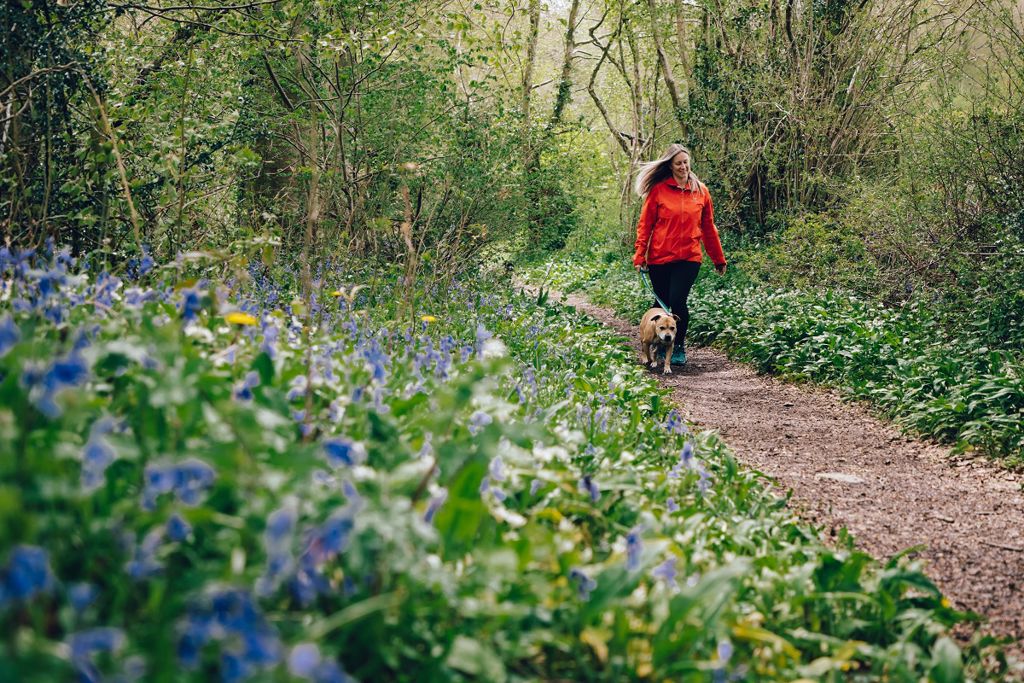
In spring the path through the woodland is edged with bluebells and primroses and the fragrance of wild garlic fills the air.
There is a picnic bench halfway around the walk.
The walking trail is waymarked from start to finish.
Look out for the information panel at the start of the trail.
Find out about walking trail grades.
You are never very far from the Nant Melindwr stream on this walk through mainly deciduous woodlands.
Enjoy a display of woodland flowers on either side of the path on the outward section of the walk in spring.
The path goes past a picnic bench before it crosses the river over a wooden footbridge.
It returns on a forest road with glimpses of the surrounding hills through the trees.

Clocaenog is a huge conifer forest which is the size of 10,000 rugby pitches (100km2).
It lies at the southern end of Hiraethog Moor and was first planted in the 1930s by the Forestry Commission.
Although still a working forest, it is now a place for people to enjoy and home for a wide variety of wildlife.
Red squirrels live in Clocaenog Forest but you will be very lucky to see one as they move over large areas and are quite secretive.
Rare black grouse, known for their flamboyant courtship display, known as ‘lekking’, live on the forest edge.
In addition to Coed y Fron Wyllt, waymarked trails start from several other Natural Resources Wales car parks in Clocaenog Forest:
We want you to return home safely after your visit here.
You are responsible for your own safety as well as the safety of any children and animals with you during your visit.
For advice and tips to help you plan your visit here go to Visiting our places safely.
See the top of this webpage for details of any planned closures or other changes to visitor facilities here.
For your safety, always follow instructions from staff and signs including those for trail diversions or closures.
We may divert or close trails whilst we undertake maintenance work or other operations and we may need to close other visitor facilities temporarily.
In extreme weather, we may close facilities at short notice due to the risk of injury to visitors and staff.
You may need permission from us to organise an event or to carry out some activities on our land.
Check if you are allowed to use our land.
We recommend you follow these directions or use the Google map below which has a pin on this place’s location.
Coed y Fron Wyllt is 3 miles west of Ruthin.
Take the B5105 from Ruthin towards Clawddnewydd.
In the village of Llanfwrog take the minor road opposite the pub signposted Bontuchel.
When you reach Bontuchel turn first left and after ½ mile Coed y Fron Wyllt car park is on the left.
The Ordnance Survey (OS) grid reference for the car park is SJ 081 570 (Explorer Map 279, 293 or 294).
The postcode is LL15 2DE. Please note that this postcode covers a wide area and will not take you directly to the entrance.
View this place on the What3Words website.
The nearest mainline railway station is in Buckley.
There is a bus stop 120 metres from the car park entrance.
For details of public transport go to the Traveline Cymru website.
Parking is free of charge.
Overnight parking is not permitted.
There are no staff at this location.
Contact our customer team for general enquiries during office hours, Monday to Friday.


