
Alwen Reservoir, near Denbigh
Walk or cycle around this huge upland reservoir
Rhyd y Gaseg is one of several car parks in Clocaenog Forest, a huge area of woodland, open moorland and rivers.
The small car park is the starting point for a short walk through the woodland and past a waterfall.
It is a woodland full of different trees including towering poplars, Douglas fir, oak and beech.
Rhyd y Gaseg means ‘the mare’s ford’ in Welsh and a ford still crosses the stream.
The weir may have been connected to the Pool Park Estate which is not far from here.
The walking trail is waymarked from start to finish.
Look out for the information panel at the start of the trail.
Find out about walking trail grades.
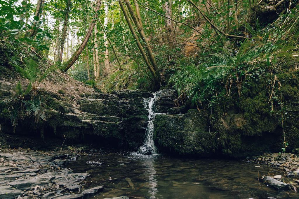
You’re never far from the sound of water on this pleasant walk through the woodland.
The waterfall is about halfway around - it can be spectacular after heavy rainfall.
In spring the path through the woodland is edged with bluebells and wild garlic.

Clocaenog is a huge conifer forest which is the size of 10,000 rugby pitches (100km2).
It lies at the southern end of Hiraethog Moor and was first planted in the 1930s by the Forestry Commission.
Although still a working forest, it is now a place for people to enjoy and home for a wide variety of wildlife.
Red squirrels live in Clocaenog Forest but you will be very lucky to see one as they move over large areas and are quite secretive.
Rare black grouse, known for their flamboyant courtship display, known as ‘lekking’, live on the forest edge.
In addition to Rhyd y Gaseg, waymarked trails start from several other Natural Resources Wales car parks in Clocaenog Forest:
We want you to return home safely after your visit here.
You are responsible for your own safety as well as the safety of any children and animals with you during your visit.
For advice and tips to help you plan your visit here go to Visiting our places safely.
See the top of this webpage for details of any planned closures or other changes to visitor facilities here.
For your safety, always follow instructions from staff and signs including those for trail diversions or closures.
We may divert or close trails whilst we undertake maintenance work or other operations and we may need to close other visitor facilities temporarily.
In extreme weather, we may close facilities at short notice due to the risk of injury to visitors and staff.
You may need permission from us to organise an event or to carry out some activities on our land.
Check if you are allowed to use our land.
We recommend you follow these directions or use the Google map below which has a pin on this place’s location.
Rhyd y Gaseg is 1 mile south west of Ruthin.
Take the B5105 from Ruthin towards Cerrig-y-drudion.
After ¼ mile, opposite the church, turn left onto a minor singletrack road.
Continue for ¾ mile and the car park is on the right.
The Ordnance Survey (OS) grid reference for the car park is SJ 111 566 (Explorer Map 256, 264 or 265.).
The postcode is LL15 2PN. Please note that this postcode covers a wide area and will not take you directly to the entrance.
View this place on the What3Words website.
The nearest mainline railway station is in Buckley.
For details of public transport go to the Traveline Cymru website.
Parking is free of charge.
Overnight parking is not permitted.
There are no staff at this location.
Contact our customer team for general enquiries during office hours, Monday to Friday.


