
The Arch, near Aberystwyth
Walks through huge beech trees with views over...
A small part of the Birchgrove Woodland Walk is blocked by fallen trees, but access is still possible along the council road.
Black Covert is a peaceful spot by the River Ystwyth which flows through this steep sided valley on its way to Aberystwyth.
It got its name from the nearby Trawsgoed (Crosswood) Estate it was once part of - a ‘covert’ is an area for raising game, in this case most likely pheasants.
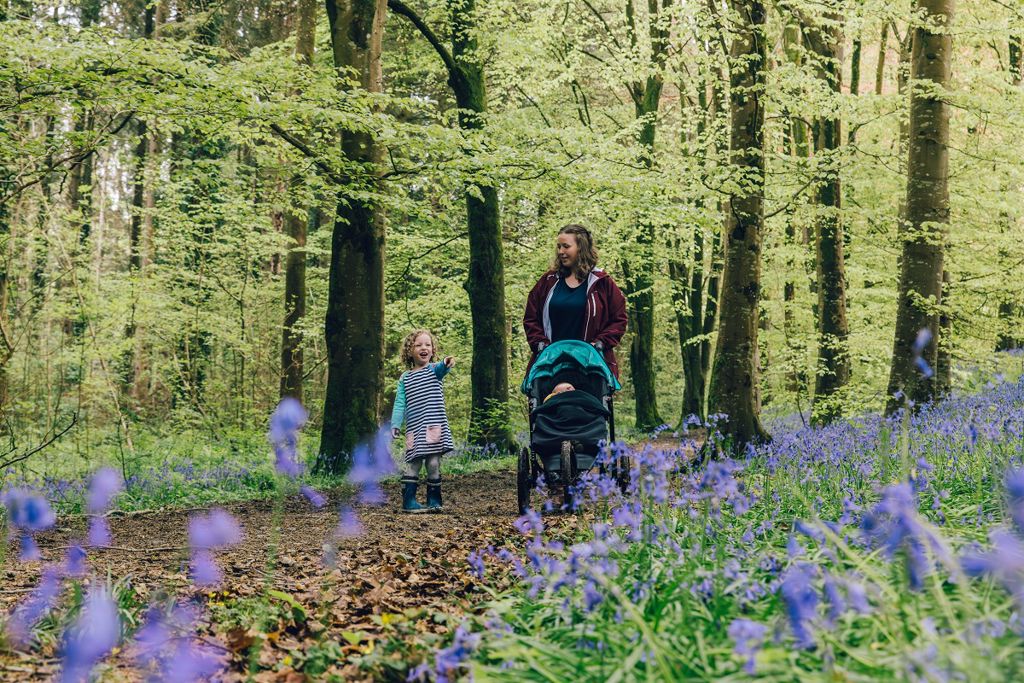
The Ystwyth Riverside Walk is an easy trail through the beech woodland which is carpeted with bluebells in spring.
The more strenuous Birch Grove Woodland Walk goes up to a viewpoint on a 2000 year-old hillfort.
There’s also a short trail for horseriders.
The picnic area is within the shelter of large ash, birch and sweet chestnut trees.

The walking trails are waymarked from start to finish.
Look out for the information panel at the start of the trails.
Find out about walking trail grades.
This trail offers a gentle walk alongside the river Ystwyth, returning through woodland filled with the scent of resin.
Bluebells carpet the ground under the beech trees in spring and there are lots of fungi in the autumn.
You may even catch the lightning streak of a kingfisher hunting along the river.

The trail passes an attractive pond and climbs up to the 2000 year-old hillfort of Allt Fedw.
There is a bench at the viewpoint from where you can take in panoramic views across rolling hills and valleys all the way to Mid Wales’ highest mountain, Pumlumon.

The horse riding trail starts from a forest road near the car park.
The trail is waymarked from start to finish.
Look out for the information panel at the start of the trail.
Enjoy a variety of surfaces, woodlands and open areas and take in distant views beyond the woodland.
We want you to return home safely after your visit here.
You are responsible for your own safety as well as the safety of any children and animals with you during your visit.
For advice and tips to help you plan your visit here go to Visiting our places safely.
See the top of this webpage for details of any planned closures or other changes to visitor facilities here.
For your safety, always follow instructions from staff and signs including those for trail diversions or closures.
We may divert or close trails whilst we undertake maintenance work or other operations and we may need to close other visitor facilities temporarily.
In extreme weather, we may close facilities at short notice due to the risk of injury to visitors and staff.
You may need permission from us to organise an event or to carry out some activities on our land.
Check if you are allowed to use our land.
We recommend you follow these directions or use the Google map below which has a pin on this place’s location.
Black Covert is 9 miles south east of Aberystwyth.
Take the B4340 from Aberystwyth to Trawsgoed.
After going through Abermagwr, turn right over the bridge (signed Llanilar B4575) then turn immediately left and left again into the car park.
The Ordnance Survey (OS) grid reference for the car park is SN 667 729 (Explorer Map 213).
The postcode is SY23 4AT. Please note that this postcode covers a wide area and will not take you directly to the entrance.
View this place on the What3Words website.
The nearest mainline railway station is in Aberystwyth.
For details of public transport go to the Traveline Cymru website.
Parking is free of charge.
Overnight parking is not permitted.
There are no staff at this location.
Contact our customer team for general enquiries during office hours, Monday to Friday.


