
Black Covert, near Aberystwyth
Woodland with riverside picnic site, walking trails...
Although all trails are open, storms have caused extensive damage in this area and the recovery work will take some time.
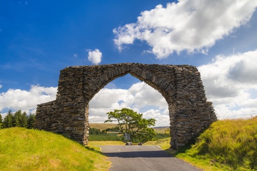
The Arch car park and picnic area is named after a spectacular old masonry arch which sits by the side of the road and was once the gateway to the nearby Hafod Estate.
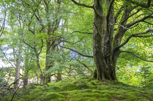
The three short walking trails all lead through huge beech trees planted over 200 years ago by Thomas Johnes who designed the Hafod mansion and grounds, and the viewpoint from the Panorama Walk has far-reaching views.
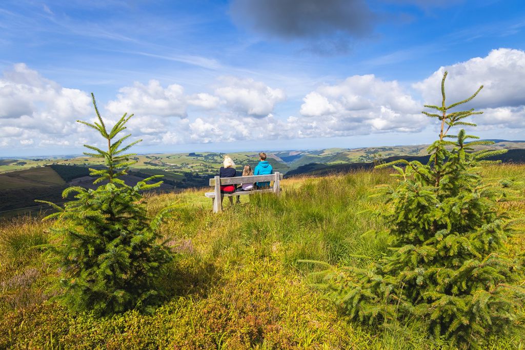
There are picnic tables on the grassy slope by the car park overlooking the arch.
The arch was built in 1810 to mark the Golden Jubilee of King George III and the road used to run through it!
The walking trails are waymarked from start to finish.
Look out for the information panel at the start of the trails.
Find out about walking trail grades.
See huge 200 year-old beech trees planted by Hafod Estate designer, Thomas Johnes, on this short trail.
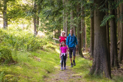
The Arch Woodland Trail winds its way uphill, passing through several areas of broadleaved trees.
It has views to the surrounding hills, especially in the areas where trees have been felled recently.
After a short but steep climb through heather and bilberry, you’ll reach the viewpoint with bench and panoramic views over the surrounding hills - on a clear day you can see Cadair Idris many miles away in Eryri National Park.
The trail continues down a steep slope and returns to the car park through areas of huge beech trees.

This long distance trail crosses some of the highest and wildest parts of Wales on its journey from the coast at Cardiff to Conwy.
The section between Cwmystwyth and Devil's Bridge goes through the woodland here.
Find out more about The Cambrian Way.
The Arch has been designated as a Dark Sky Discovery Site as it is one of the best local places to see the stars.
It is located in the Cambrian Mountains which have some of the darkest night skies in Europe.
Dark Sky Discovery Sites are places that:
Get tips for enjoying the night sky on the UK Dark Sky Discovery Partnership website
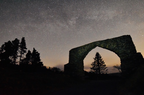
Photo: Dafydd Wyn Morgan
We want you to return home safely after your visit here.
You are responsible for your own safety as well as the safety of any children and animals with you during your visit.
For advice and tips to help you plan your visit here go to Visiting our places safely.
See the top of this webpage for details of any planned closures or other changes to visitor facilities here.
For your safety, always follow instructions from staff and signs including those for trail diversions or closures.
We may divert or close trails whilst we undertake maintenance work or other operations and we may need to close other visitor facilities temporarily.
In extreme weather, we may close facilities at short notice due to the risk of injury to visitors and staff.
You may need permission from us to organise an event or to carry out some activities on our land.
Check if you are allowed to use our land.
We recommend you follow these directions or use the Google map below which has a pin on this place’s location.
The Arch car park is 13 miles south east of Aberystwyth.
Take the A4120 from Aberystwyth to Devil's Bridge, then follow the B4574 for Cwmystwyth.
After 2 miles, pass a stone arch and the car park is on the left.
The Ordnance Survey (OS) grid reference for the car park is SN 765 755 (Explorer Map 213).
The postcode is SY23 3JN. Please note that this postcode covers a wide area and will not take you directly to the entrance.
View this place on the What3Words website.
The nearest mainline railway station is in Aberystwyth.
For details of public transport go to the Traveline Cymru website.
Parking is free of charge.
Overnight parking is not permitted.
There are no staff at this location.
Contact our customer team for general enquiries during office hours, Monday to Friday.


