Afan Forest Park – Visitor Centre, near Port Talbot
Main starting point for mountain bike and walking...

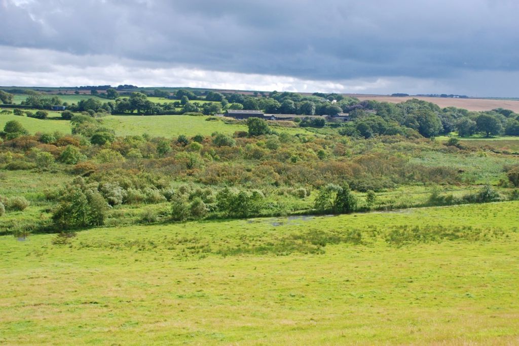
Llangloffan Fen National Nature Reserve is part of the largest floodplain in Pembrokeshire.
A wide range of plants and wildlife are supported by the reserve’s habitats of dense fen and reed swamp, wet woodland and marshy grassland.
This mix of habitats developed after the river that once flowed through the valley was forced to forge a new course around 12,000 years ago after a glacier dumped clay and other materials here.
We look after this wetland habitat by ensuring that the water level is never allowed to drop too low, and we allow cattle and ponies to graze on the fen in summer and autumn to keep the vegetation in check.
The best way to experience this special landscape is to follow the wheelchair-accessible boardwalk over part of the reserve.
The walking trail is waymarked from start to finish.
Look out for the information panel at the start of the trail.
Find out about walking trail grades.
Discover the fen, swamp and wet woodland on our fully accessible boardwalk.

Llangloffan Fen is a National Nature Reserve.
National Nature Reserves are places with some of the very finest examples of wildlife habitats and geological features.
The landscape and wildlife varies depending on which time of year you visit – here’s what to look out for.
Along the wetter parts of the reserve, the wonderful frothy cream blooms of meadowsweet fill the air in summer with their delicious scent as they push through the reeds and sedges. Also look for:
The wet woodland has an ancient feel, its trees cloaked in velvety mosses and silvery lichens. Other plants here include:
Along the river there are:
Birds to look or listen out for include:
There are over 70 National Nature Reserves in Wales.
Find out more about National Nature Reserves.
The western part of Llangloffan Fen National Nature Reserve is managed by the Wildlife Trust of South and West Wales.
This part of the reserve has a circular path from a parking area on the B4331 to a bird hide overlooking an area of open water.
For more information go to the Wildlife Trust of South and West Wales website.
We want you to return home safely after your visit here.
You are responsible for your own safety as well as the safety of any children and animals with you during your visit.
Please note:
For advice and tips to help you plan your visit here go to Visiting our places safely.
The Llangloffan Fen Walk follows a boardwalk from the entrance of the reserve and returns along the same route. The boardwalk is suitable for wheelchair users and people with prams or pushchairs.
See the top of this webpage for details of any planned closures or other changes to visitor facilities here.
For your safety, always follow instructions from staff and signs including those for trail diversions or closures.
We may divert or close trails whilst we undertake maintenance work or other operations and we may need to close other visitor facilities temporarily.
In extreme weather, we may close facilities at short notice due to the risk of injury to visitors and staff.
You may need permission from us to organise an event or to carry out some activities on our land.
Check if you are allowed to use our land.
We recommend you follow these directions or use the Google map below which has a pin on this place’s location.
Llangloffan Fen National Nature Reserve is 6½ miles south west of Fishguard.
From Fishguard take the A487 towards St Davids.
Turn sharply left onto the B4331 signposted to Castlemorris.
Go past the Wildlife Trust of South and West Wales car park on the left and take the next left at a crossroads, signposted to Hayscastle Cross.
Follow this minor road for ¼ mile and the lay-by parking area and reserve entrance is on the right, just before the road goes over a stone bridge.
The Ordnance Survey (OS) grid reference for the lay-by is SM 904 319 (Explorer Map OL 35).
The postcode is SA62 5ER. Please note that this postcode covers a wide area and will not take you directly to the entrance.
View this place on the What3Words website.
The nearest mainline railway station is in Fishguard and Goodwick.
For details of public transport go to the Traveline Cymru website.
Parking is in a lay-by near the reserve entrance.
There are no staff at this location.
Contact our customer team for general enquiries during office hours, Monday to Friday.